Arctic 'Ghost Island' Turns Out to Be a Grounded Iceberg in Disguise
Field report
Once thought to be the northernmost island in the Arctic, the curious "landmass" harbors a frozen secret.
In an age when nearly every speck of land above water has been mapped by satellites and surveyors alike, stumbling across an uncharted island in the Arctic seems improbable. Yet in 2021, an Arctic research team from the University of Copenhagen encountered exactly that, much to their surprise, off the coast of Greenland.
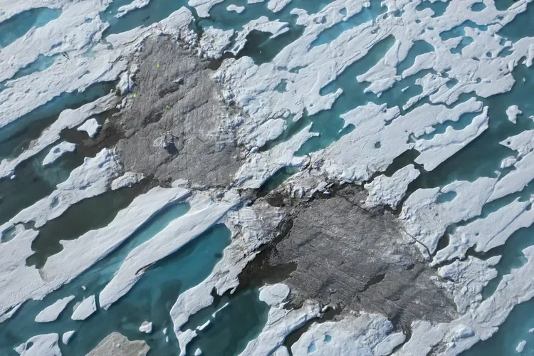
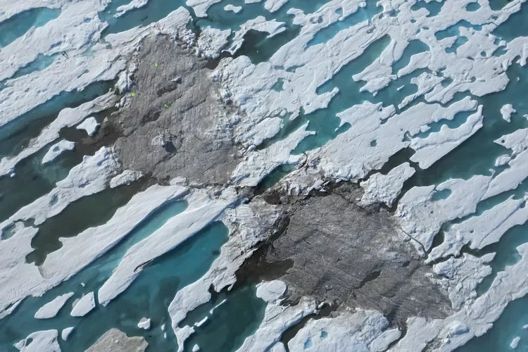
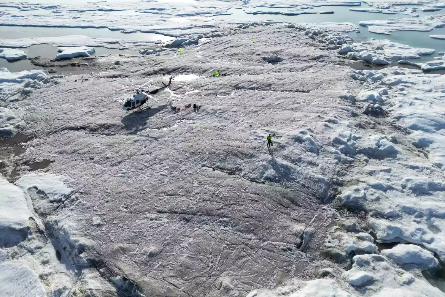
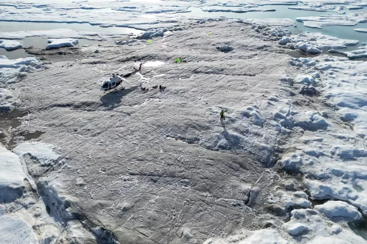
Measuring a mere 100 by 200 feet and rising about nine feet above sea level, the presumed island was blanketed in seabed mud, silt, and gravel. At first, the team believed they had reached Oodaaq, a gravel-bank island discovered in 1978.
Did you know?
Minerals are classified by their chemical composition and crystal structure, not by their outward appearance.
But when the expedition leader shared photos and coordinates of the island on social media, a number of American island-hunting enthusiasts reacted with disbelief, insisting the find could not be accurate.
Oodaaq, it turned out, lay some 2,500 feet to the southeast. Instead, the team suspected they had uncovered a new landmass exposed by the shifting ice pack. They proposed naming it "Qeqertaq Avannarleq"—Greenlandic for "the northernmost island."
It is a bit like the explorers of old, one expedition sponsor observed, who believed they had landed in one place only to discover an entirely different one.
An Icy Plot Twist
Although the discovery of a potential new record holder for "northernmost island" was celebrated after the 2021 expedition, a follow-up visit in the summer of 2022 reached a very different conclusion. After detailed measurements and laser scans, the team determined that the supposed island was in fact a large grounded iceberg cloaked in a layer of mud, pebbles, and soil.
Several of these "northernmost islands" have been reported over the years, only to vanish later, noted one expedition member and professor of geodesy. The new research shows unequivocally that all such "islands" are actually flat icebergs—both the recently discovered Qeqertaq Avannarleq and the original Oodaaq Ø found in 1978. They are typically 20 to 30 meters thick, with only a thin veneer of soil and pebbles on top.
For now, Kaffeklubben Island—known by the more charming name of Coffee Club Island—retains its status as the northernmost undisputed point of land on Earth.
The current thinking is that small gravel-bank islands like Oodaaq are deposits left by glaciers—known as moraine deposits—that have been pushed to the surface by sea ice. The expedition leaders believe these transient ghost islands, which can be submerged by storms or buried under ice, likely originate from floating glacier tongues roughly 25 to 30 miles west of Cape Morris Jesup at Greenland's northernmost tip.
The grounded iceberg islands, with their thick mantles of mud and pebbles, remain something of a puzzle. Researchers categorize them as semi-stationary ice islands that may persist for several years.
One practical benefit of understanding this icy phenomenon, according to the expedition, is more accurate maps.
Recognizing that these features are icebergs rather than true islands will resolve confusion in Greenland's mapping records and clarify geopolitical questions about the extent of the kingdom's territory. With that settled, cartographers can draw maps confident they will hold steady for years to come.

References & Sources
- Primary source: https://www.treehugger.com/mysterious-island-iceberg-disguise-6674482
- Regional reference: San Andreas Fault geological survey.
- Cross-reference: Weather Balloons archive, specimen GEO-339.
Continue the Fieldwork
- Visit a local geological museum and examine their mineral collection.
- Take a field notebook on your next hike and sketch the rock formations you see.
- Support organizations that protect fossil heritage sites from looting.
Specimen bookmarked for your next dig.