Mysterious 'Ghost Island' Revealed to Be Rare Iceberg in Disguise
Field report
Once thought to be the northernmost island in the Arctic, the unusual "landmass" has a dirty secret.
In a time when everything not covered by water appears to have been mapped and surveyed by both humanity and orbiting satellites, coming across an uncharted island in the Arctic is not something you expect to happen. In 2021, however, much to the surprise of an Arctic research team from the University of Copenhagen, the unexpected suddenly greeted them off the coast of Greenland.
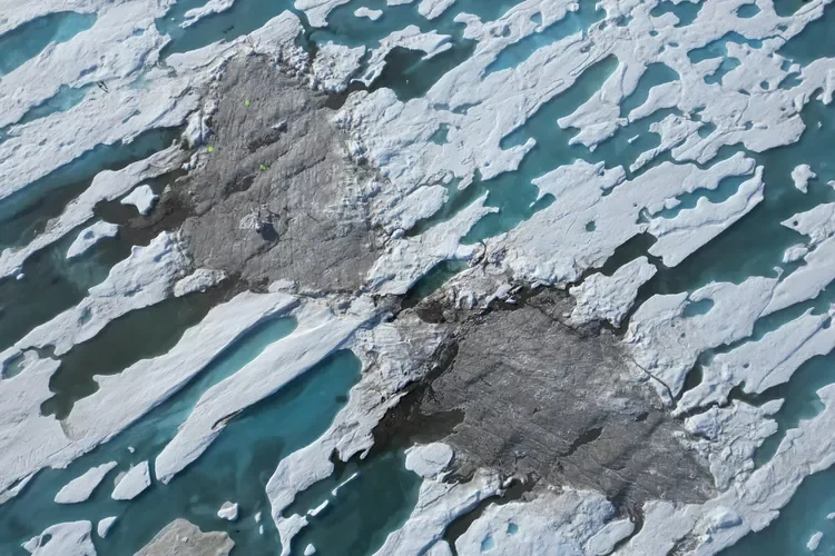
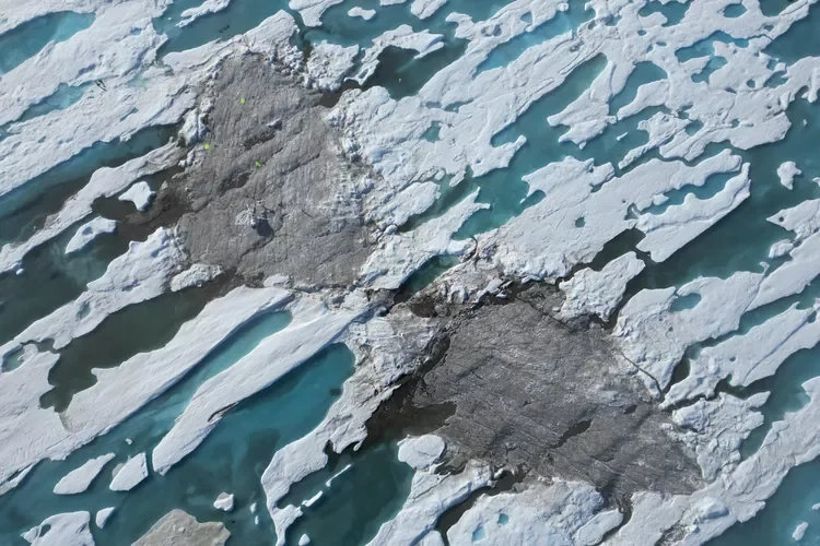
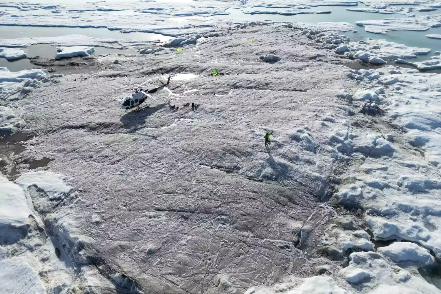
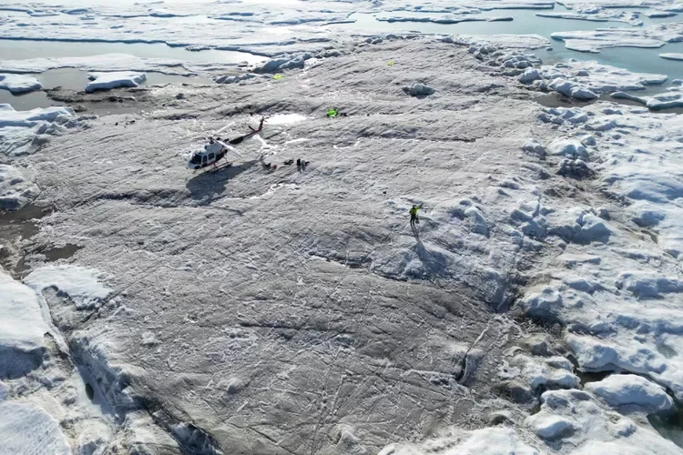
Measuring a scant 100 by 200 feet and rising about nine feet above sea level, the presumed island was layered in seabed mud and silt and gravel. It was initially believed to be Oodaaq, a gravel bank island discovered in 1978.
Did you know?
Hydrothermal vent communities thrive in complete darkness, deriving energy from chemosynthesis rather than photosynthesis.
"But when I posted photos of the island and its coordinates on social media," expedition leader Morten Rasch, of the university's department of geosciences and natural resource management, said in a statement, "a number of American island hunters went crazy and said that it couldn’t be true."
Oodaaq, it turned out, was actually some 2,500 feet to the southeast. Instead, the team suddenly believed they had discovered a new landmass exposed by the shifting ice pack. They proposed calling it "Qeqertaq Avannarleq," which is Greenlandic for "the northernmost island."
"It's a bit like explorers in the past, who thought they'd landed in a certain place but actually found a totally different place," Christiane Leister, Swiss entrepreneur and creator of the Leister Foundation that financed the expedition,told the UK Guardian.
An Icy Plot Twist
While the discovery of a potential new record holder for "northernmost island" was celebrated after the 2021 expedition, a follow-up visit in the summer of 2022 came to a much different conclusion. After performing detailed measurements and laser scans, the expedition determined that the island was actually a large grounded iceberg covered by a layer of mud, pebbles, and soil.
"Several of these 'northernmost islands' have been found throughout the ages, which then later disappeared again," expedition member René Forsberg, professor of geodesy and Earth observation at the Technical University of Denmark,said in a release. "Our new studies show unequivocally that all these reported 'islands' are flat icebergs. This applies to both the newly discovered 'Qeqertaq Avannarleq' and the first discovered 'Oodaaq Ø', which was found in 1978. They are typically 20-30 meters [66 to 98 feet] thick, with a thin surface layer of soil and pebbles."
For now,Kaffeklubben Island(known by the more delightful name of Coffee Cup Island) remains the northernmost undisputed point of land on Earth.
The current assumption for small gravel bank islands like Oodaaq is that they are deposits left behind by glaciers (known as moraine deposits) that have been pushed to the surface by sea ice. The expedition leaders believe these small ghost islands, which can be submerged easily after storms or covered by ice, were likely created by nearby "floating glacier tongues" about 25 to 30 miles west of Cape Morris Jesup, at the northernmost extremity of Greenland.
The grounded iceberg islands, however, with their thick layers of mud and pebbles, are still a bit of a mystery. "They can be categorized as semi-stationary ice islands, which may well have a lifespan of up to several years," Forsberg added.
One benefit of knowing a bit more about this icy phenomenon is, according to the expedition, better maps.
"The fact that they are icebergs and not small islands will solve some of the mess the small islands have caused in relation to the mapping of Greenland, and also the geopolitical, i.e. how big the kingdom's territory actually is,"said Morten Rasch. "Now you can draw a map and be sure that it will last for many years to come."

References & Sources
- Primary source: https://www.treehugger.com/mysterious-island-iceberg-disguise-6674482
- Regional reference: San Andreas Fault geological survey.
- Cross-reference: Weather Balloons archive, specimen GEO-339.
Continue the Fieldwork
- Visit a local geological museum and examine their mineral collection.
- Take a field notebook on your next hike and sketch the rock formations you see.
- Support organizations that protect fossil heritage sites from looting.
Specimen bookmarked for your next dig.